


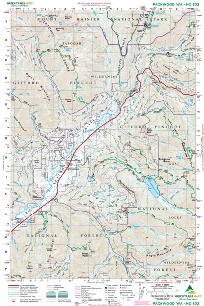
Packwood, WA - 302 Map
Pickup available at Whittaker Mountaineering
Usually ready in 24 hours
Packwood, WA - 302 Map
Whittaker Mountaineering
30027 SR 706 E
Ashford WA 98304
United States
Description
Navigation for the gateway to the Goat Rocks.
Green Trails Map 302 provides essential topographical detail for the Packwood area, serving as a critical navigational tool for exploring the Tatoosh Wilderness and the approaches to the Goat Rocks. Whether you are planning a trek to Packwood Lake or navigating the forest roads around the Ranger Station, this map offers the reliable trail, road, and access information needed for efficient travel in these rugged landscapes. Revised in 2013, it ensures you have the data necessary to find your way through this key access point for the South Cascades.
Details & Features
Specs & Materials
Sizing
See Specs tab for Sizing Details
Navigation for the gateway to the Goat Rocks.
Green Trails Map 302 provides essential topographical detail for the Packwood area, serving as a critical navigational tool for exploring the Tatoosh Wilderness and the approaches to the Goat Rocks. Whether you are planning a trek to Packwood Lake or navigating the forest roads around the Ranger Station, this map offers the reliable trail, road, and access information needed for efficient travel in these rugged landscapes. Revised in 2013, it ensures you have the data necessary to find your way through this key access point for the South Cascades.
See Specs tab for Sizing Details

We Simplify
Outfitting
Whittaker Mountaineering was born out of the need for RMI to make sure their clients had the appropriate gear to get to the top of Mt. Rainier safely. After decades of trying, reviewing, arguing-over, and recommending gear, we can’t help but know what we’re doing by this point. We know what works, we know what doesn’t, and we use that expertise to stock our store.
- Free Shipping On orders over $150
- Easy Returns - 30 days, no hassle returns